
Aldbury, Ashridge and Tring Park
A choice of stile-free walks visiting Aldbury, Ashridge and Tring Park.
DISTANCE: Full walk 8 miles/13km; Ashridge only option 5.8 miles/9.2km; Wigginton 5 miles/8km
TERRAIN: Easy walking on good paths with numerous gates. The full walk has two main uphill sections (total ascent 850ft/260m). Both shorter routes have one climb. The Ashridge option has a total ascent of 490ft/150m, and Wigginton 360ft/110m
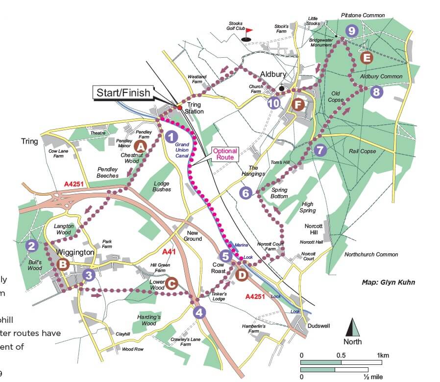
START: Tring Railway Station, Station Road, Tring HP23 5QR. (Please use the station car park). Alternative start points: National Trust Ashridge Estate Visitor Centre (nearest postcode HP4 1LT), and Wigginton Sports Ground, Chesham Road, Wigginton HP23 6HH
MAPS: OS Explorer 181, Chiltern Society 18 & 19
REFRESHMENTS: The walk passes by or near three pubs: The Greyhound (Wigginton), The Valiant Trooper and The Greyhound (Aldbury); and three cafés: The Village Shop & Café (Wigginton); Brownlow Café (Ashridge) and Musette Café (Aldbury)
You can view the Chiltern Society’s full details of the walk here.
The Walk
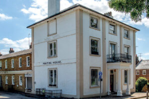
Turn left out of the station, walk past the Posting House (a former hotel) as far as the canal bridge and turn left along Beggars Lane.
*The optional Ashridge route starts from the canal bridge.
- Where the lane narrows, take the path on the right past the barrier and continue uphill following signs for The Ridgeway. Follow this ancient trail for the next 1.4 miles. Cross the busy road, turn right up the surfaced path and then left up the path signposted The Twist. Cross the footbridge and continue uphill through a series of gates to a lane. Turn right for a few metres and left up the steps towards Tring Park. Stay on this path through more gates to reach a busy lane. Cross to the gravel driveway opposite, bear right along it and past a barrier into Tring Park.
- Turn immediately left, follow the edge of the wood and go through a barrier to a surfaced driveway. Cross straight over, follow the path to a lane and turn left along it. The entrance to the sports ground, village shop and café is further down on the right. Continue down the lane to a road junction, turn right past the front of The Greyhound to the pub car park.
- Cross the road to a path signposted Crawley’s Lane. Go through the gate and continue downhill through three further gates into a wood. Follow the path straight down past the junction with The Chiltern Way and out through the next gate into a field. The route follows The Chiltern Way for the next 2.5 miles. Continue directly ahead through the horse paddocks and three more gates to a path T-junction in the hedgerow. Turn right to join a concrete track down to a lane. Turn left under the flyover and take the byway on the right, signposted Cow Roast.
 Go through the gates of Tinkers Lodge and walk along the wide track to reach a busy road by the closed Cow Roast Inn. Cross the road, turn right along the verge, take the first left down Wharf Lane and over the canal bridge. *The optional Wigginton route starts here.
 Follow the lane round to the right, walk along it for 110m and turn left through a gap in the hedgerow. Go straight over the field, cross the railway bridge and the next field to a T-junction. Turn right to the next junction and then left to the main access track into Norcott Court Farm. Turn left and immediately right just before the farm entrance. Continue up past the metal barn, go through a gate, walk on a few metres and bear left through a gate in the wooden fencing. Follow the path ahead to the top of the field and go through a gate. Walk along the right-hand field edge and up through a small wood. Go through the next gate, bear left uphill and through a further gate. Follow the path down for a short distance and round to the right to a tall field gate.
- Pass through the gate. Continue uphill through the wood and the next gate. Stay straight ahead to join a surfaced driveway, walk past the houses and onwards to a lane.
- Cross it and turn right uphill on a path that runs parallel to the lane. At the top, turn left along a wide track, go through the gate directly ahead and past Old Copse Lodge. Continue directly ahead along the track for 550m to a 5-way junction.
- Turn immediately left to a path junction with views of the Bridgewater Monument directly ahead. Turn right along a wide track and follow it all the way to Ashridge Visitor Centre.
 From the entrance to the Centre, follow the fence round to the left past Brownlow Café and Monument Cottage. Stay straight ahead, follow the main path downhill for 200m and bear right to keep descending to a road (Toms Hill Road). Turn right, go over the road junction, walk past the pond, the Post Office and Aldbury Memorial Hall and along Station Road.
- Just after the church, turn right through a gate on a path signposted Pitstone Hill and cross the field. (Musette Café is on the left through a gap in the fence). Go through the next gate and left through a third just before a large barn. Follow the path beside the barn and on through two more gates to reach a T-junction. Turn left, go over a crossing path, down the concrete track and through a gate to reach a busy road. The official route turns right along the verge to return to Tring Station. For a safer alternative, cross the road and turn right along the field edge on an unofficial but well-used route. At the end go past a gate, cross the road and turn left along the pavement to the station.
*Ashridge shorter option – Don’t turn left into Beggars Lane. Instead, cross the road and walk down the slope to the canal. Turn left and walk along the towpath for just over a mile to a lane at Cow Roast Lock. Turn left along the lane to join the main route at Waypoint 5.
*Wigginton shorter option – After the bridge, turn immediately left past the lock and continue along the canal towpath for just over a mile to Bridge 135. Go under the bridge and turn immediately right up the slope to the road. Turn left along it to reach Tring Station and the end of the walk.
Points of Interest
Tring Station, constructed by railway engineer Robert Stephenson, was opened by the London and Birmingham Railway in 1837.
Cafés: This walk will take you past two of the many cafés that have opened in The Chilterns recently – Musette Café, Aldbury, based in Church Farm, a former stable yard for racehorses, and the award-winning, community-owned and managed Wigginton Village Shop & Café.
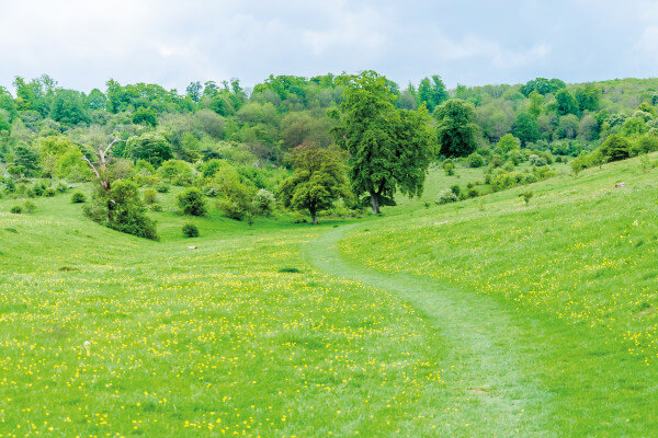
A. The Ridgeway National Trail is 87 miles long. It starts in the World Heritage Site of Avebury and crosses the chalk ridges of the North Wessex Downs and Chilterns AONB. The Chilterns section travels through woodlands, nature reserves and quiet valleys, passing several magnificent viewpoints on the ridge. The route has been used for at least 5,000 years by travellers, herdsmen and soldiers.
B. Wigginton was recorded as Wigentone in the Domesday Book. The Grade II listed Church of St. Bartholomew dates from the 12th century. Champneys health spa and the beautiful Tring Park are nearby.
C. The Chiltern Way is a 134-mile circular trail designed by the Chiltern Society, highlighting the best features of our historic landscape. Suitable for walkers of all abilities, the route is well signposted and regularly checked by volunteers.
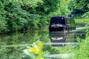
D. Cow Roast probably gets its name from ‘cow rest’, because it lies on one of the major droving routes into London. Akeman Street, a Roman road from St Albans to Cirencester, ran through the village. In 1972, the local archaeological society started excavations and many Roman artefacts were found. The Grand Union Canal runs from London to Birmingham. It’s an amalgamation of several historic waterways. This section opened at the end of the 18th century as part the Grand Junction Canal, which linked the Thames at Brentford to Braunston in Northamptonshire.
E. Ashridge Estate dates back over 700 years to when a monastery was founded. Henry VIII bequeathed the Estate to the future Queen Elizabeth I, who lived there before being arrested by her half-sister Mary and taken to the Tower of London. One of its later owners was Francis Egerton, 3rd Duke of Bridgewater also known as the ‘Canal Duke’. He built the Bridgewater Canal, regarded as the first true canal in Britain. The monument was erected in 1832 in his memory. It’s 33m high and is open to the public. The Estate now belongs to the National Trust and is a haven for wildlife.
F. Aldbury was listed in the Domesday Book as Elderberie, meaning ‘old burh’, or old fortification. The village is often used for filming. Notable productions include Midsomer Murders, The Dirty Dozen and
Bridget Jones.
Images: Colin Drake
You can view the Chiltern Society’s full details of the walk here.
Our thanks to Andrew Clark of the Chiltern Society, for supplying this walk.