
Berkhamsted and Ashridge
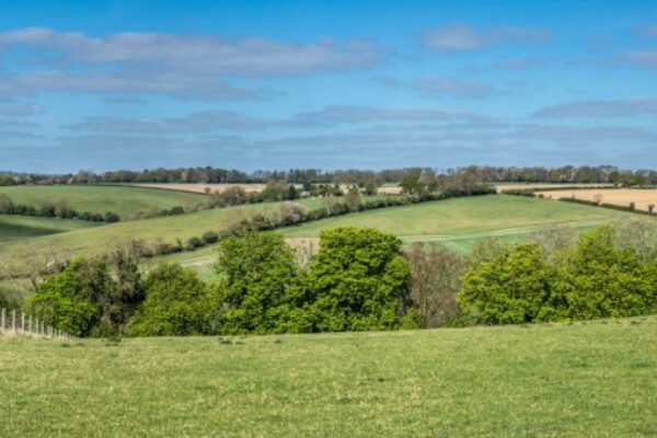
This stile-free walk offers some great views over Berkhamsted from Ashridge as well as fields, valleys and woodland.
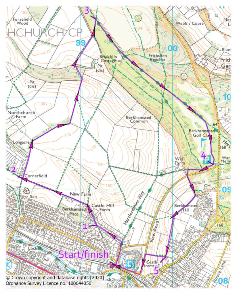
START/END: Berkhamsted Railway Station, Station Approach, Berkhamsted HP4 2AR
DISTANCE: 5 miles
MAPS: OS Explorer 181, Chiltern Society 17 & 20
TERRAIN: Easy stile-free walking on level paths with three uphill sections
PARKING: Berkhamsted Railway Station and several other places in Berkhamsted
LOCAL TRANSPORT: Berkhamsted is served by many bus routes. Berkhamsted station is on the main line between Euston and Birmingham
You can download the Chiltern Society’s full description and annotated map of the walk here.
A five-mile stile-free walk on level ground with three short uphill sections, taking in some great views of the urban landscape, valleys and woodland to the north and west of Berkhamsted. Wide, field-edge paths make it perfect for people that need to create space between each other, and the woodland paths are also wide. This circular route starts and finishes at Berkhamsted Station.
Route
Leave the station from the Long Stay car park exit. Cross straight over the access road and Bridgewater Road and continue up Brownlow Road and, where that bends right, continue straight ahead up Castle Hill to a road junction at the top.
1. Waypoint 1. Fork right, walk between newly-built houses to the end through the gate ahead into a field. Continue along the field edge and through two further gates to a path junction.
2. Waypoint 2. Turn right through the gate and follow the hedgerow on the left for 850m into the next field. Fork left and continue through two more gates down to the information board in Alpine Meadow Nature Reserve. Climb up through a gate and continue uphill through two further gates into a field. Stay straight ahead past a series of gates to the first ‘T’-junction and turn left to the next.
3. Waypoint 3. Turn right and keep following this path in the same direction, ignoring left and right turns, to reach a golf course and then the car park near the war memorial.
4. Waypoint 4. Take the path at the back of the car park and turn right downhill. At the second path junction turn left to a road. Cross and follow the path up towards a large house at the top of the hill. Turn right and follow this elevated path at high level for 750m until it turns right downhill at a row of trees.
5. Waypoint 5. There are two options at this point. To follow the official right of way, turn right down to the bottom, through a gate, cross the road and turn left along the pavement. Follow the road round to the right with the elevated railway line on your left to reach the station. To follow the local path, turn right down to a crossing path, turn left under the row of trees to reach the road. Cross and turn left to rejoin the main route to the station.
Points of Interest
Waypoint 1: Puddingstones are a ‘conglomerate’ of rounded flint pebbles in a matrix of fine sand all cemented together by silica.
Waypoint 2: Alpine Meadows is a Site of Special Scientific Interest (SSSI) – a chalk grassland rich in wildflowers and butterflies from spring to autumn.
You can download the Chiltern Society’s full description and annotated map of the walk here.