
Circular Walk Around Tring Park
The old market town of Tring’s most well-known residents were the Rothschild family and this walk explores their influence on the town and the surrounding countryside. It includes a world famous museum, a magnificent village hall, a few follies and the all year round beauty of Tring Park.
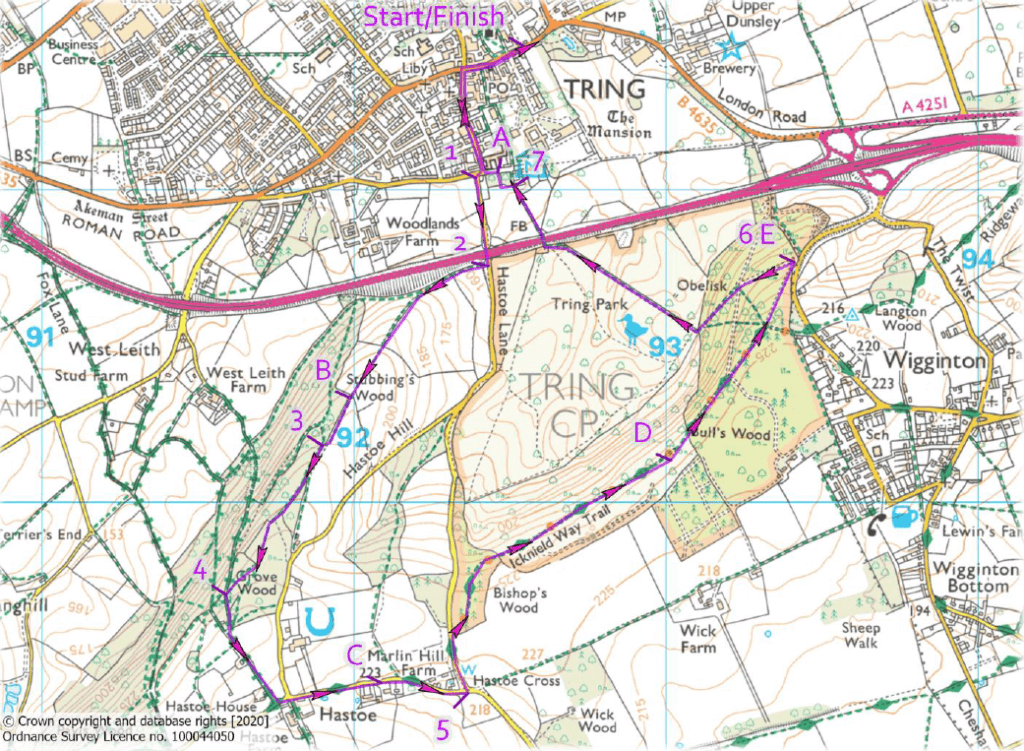
DISTANCE: 4.2miles
TERRAIN: Easy walking on paths and lanes with one gradual climb.
START/FINISH: The Forge car park, High Street, Tring HP23 5AG. Grid ref: SP 925 115
FOOD & DRINK: Plenty of pubs and cafés in Tring. None on the walk.
MAPS: OS Explorer 181, Chiltern Society 18
PARKING: The Forge car park, High Street, Tring HP23 5AG
LOCAL TRANSPORT: There are various bus services to Tring from Aylesbury, Chesham, Hemel Hempstead, Leighton Buzzard, Luton and Watford. Tring is also served by mainline trains out of Euston, although the station is located on the outskirts of the town.
You can view the Chiltern Society’s full details of the walk here.
The Walk
Leave the car park via the main entrance and turn right along the High Street. Take the second left up Akeman Street to the T-junction at the top.
Waypoint 1 – Turn right, then immediately left into Hastoe Lane, walk along it and go under the flyover to a path on the right, signposted to Stubbings Wood.
Waypoint 2 – Turn right past a gate onto a concrete track. The track becomes a path that runs parallel to the main road. After 200m bear left uphill, keeping to the right of a hedgerow. At the brow of the hill look back to see the fine views over Tring and beyond. Keep climbing on the wide track between the fences and then along the edge of a wood for 300m to a gap in the trees.
Waypoint 3 – Enter the wood, turn immediately left uphill for 130m to a path junction. Ignore the path on the left and continue uphill for a further 300m to the next junction. Fork right and follow the path as it drops down steps to a major track.
Waypoint 4 – Turn left up past the wooden barrier and bear left along the rough lane to a road junction. Turn left and, at the bend, continue straight ahead into Church Lane to follow The Ridgeway National Trail. Walk past the village hall and continue to the junction of Church Lane and Marlin Hill.
Waypoint 5 – Turn left up Marlin Hill, cross to the other side of the road and continue up the grass verge. After 200m, turn right past the wooden barrier into Tring Park. The next section is called King Charles Ride and there are extensive views over the Vale of Aylesbury. After nearly a mile the Ridgeway turns right. Do not follow it, but continue ahead and down to a white building – the Summer House.
Waypoint 6 – Follow the main path as it bends left downhill to the obelisk. Continue in the same direction down to a kissing gate. Go through it, turn right and then across the open area of the Park towards a footbridge over the A41. Go through the gates, cross the footbridge and follow the wide fenced path towards a road.
Waypoint 7 – Just before the road, turn left through a gate, walk past the car park and turn right over a bridge to a road. Turn left and immediately right down Akeman Street to the High Street. Turn right to return to the car park.
Points of Interest
Tring is a small market town lying at the edge of the Chiltern Hills, where the Roman Akeman Street meets the ancient Icknield Way. Probably the most famous resident of the town was Lionel Walter Rothschild, whose family bought the Wren-designed Tring Mansion in 1872.
A – Natural History Museum: Rothschild was a keen naturalist and built a private zoological museum. It contained one of the largest natural history collections in the world. In 1937 the Rothschild family gave the museum and its contents to the nation and it became part of the Natural History Museum.
B – Stubbings Wood is a Site of Special Scientific Interest (SSSI) and one of the best examples in Hertfordshire of ancient semi-natural beech woodland.
C – Hastoe Village: Probably first recorded in the 13th century and most notably connected with the Rothschild family. On the right along Church Lane is the magnificent village hall built by the Rothschilds in 1898. Nearby is the highest point in Hertfordshire, standing at just over 800ft.
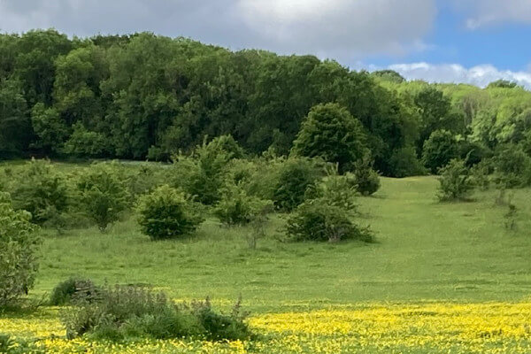
D – The Ridgeway and Tring Park: The Ridgeway has been described as Britain’s oldest road and is thought to have connected the Dorset coast to the Wash. It is now an 87 mile National Trail, opened in 1973. Tring Park dates back to 1066. For centuries it was linked to the manor of Tring and eventually became part of the Estate. In 1937 the Rothschild family sold the Estate but kept the Park. When it was threatened with development, it was bought by Dacorum Borough Council and leased to the Woodland Trust.
E – The Summer House and obelisk: Both monuments are thought to have been designed by James Gibbs, who was also responsible for St Martins in the Fields. They are reputed to have been dedicated to Nell Gwynn who, local legend says, is supposed to have visited the Park with Charles II.
You can view the Chiltern Society’s full details of the walk here.
Our thanks to Andrew Clark of the Chiltern Society, for supplying this walk.