
Graham Greene’s Common
The walk takes in various parts of Berkhamsted and Northchurch Common which feature significantly in the works of Graham Greene. The route includes Kitchener’s Field, the car park at the top of New Road (an alternative start and finish point) the Common, Frithsden Beeches and the WW1 practice trenches.
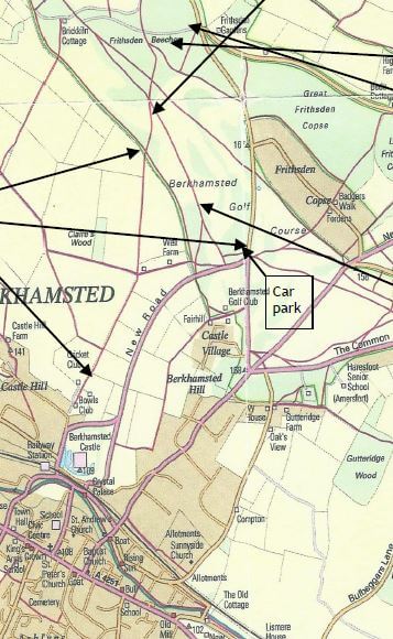
START/END: Berkhamsted Railway Station or the car park at the top of New Road
DISTANCE: 3½ miles or 2¼ miles circular
MAP: Ordnance Survey Explorer 181
You can download Berkhamsted Town Council’s map of the walk here. In addition, downloadable audio commentary points, incorporating Greene’s own writing, describe what to look out for along the way.
The Walk
Leave the railway station by way of the pedestrian subway at the Platform 4 exit, pausing to glance across at the building to your immediate left. Now the Marlin Montessori School, it was built as the private waiting room for Lord Brownlow and his guests.
Those travelling by car may prefer to go direct to the car park by the junction at the top of New Road and Ashridge Road, opposite the Inns of Court memorial.
Walk along Brownlow Road with the Castle to your right. Where the road bends right keep straight on and go through the right hand gate into the playing fields, home to Berkhamsted School Sports Ground and Kitchener’s Field Bowls Club.
Where the tarmac gives way to footpath, continue ahead through the fields with the hedge to your left. The line of trees up the hill ahead of you marks the edge of Berkhamsted Common.
With the road and memorial behind you, take a made-up footpath at the left hand corner (56) and follow it down hill, parallel to New Road. (Those who have just walked uphill should retrace your steps.) Just before the junction with the Well Farm access lane turn right and follow a clay path (unnumbered) through the trees at the edge of the Common, with occasional glimpses of Well Farm and its fields through gaps to your left. After some 700 metres you come to a junction of paths, with a kissing gate on your left.
The path (51) now leads uphill, but, before continuing take a moment to go through the gate and enjoy the view.
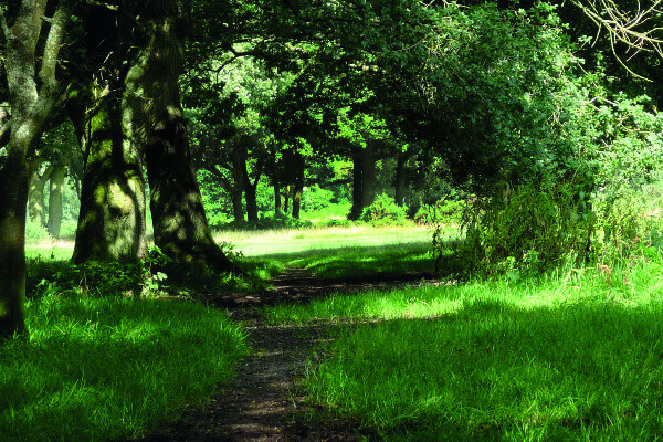
Leaving the kissing gate directly behind you, go uphill and you will find the abandoned rifle butt a few steps to the right off footpath 51, ‘the steep clay path between oaks and beeches above Kitchener’s Fields’, just before the open Common. It is better approached from behind as the side towards the path is quite steep. At one time it commanded a 180-degree vista of the whole stretch of the valley back towards Berkhamsted. Sadly, today the many years of unchecked growth of scrub have blocked out the view – and indeed have so obscured the mound that it is possible to walk past it and miss it altogether.
Retrace your steps to the path and continue uphill to the open common. As the ground levels out, follow a diagonal path, crossing two bridleways, and passing through Frithsden Beeches. The complete walk, approximately 1km from the rifle butt, takes you to a metalled track, the access road to Brick Kiln Cottage (bridleway 53), at its junction with Ashridge Road.
Follow the same path in the reverse direction until you reach the junction with the second bridleway, its marker post helpfully marked in indelible marker pen 55. Turn left, heading for the WW1 trenches, a 600-metre fragment revealed by the 2012-2014 Trenches Project.
Leaving the trenches behind continue walking along the bridleway in the same direction and the car park is 350 metres away, to your left.
For those returning on foot to the railway station, follow the route by which you came up, past Well Farm and through the fields to Brownlow Road and past the Castle, now to your left. The railway station is straight ahead of you.
You can download Berkhamsted Town Council’s map of the walk here.
The Audio Trail has been produced by Berkhamsted Town Council, Northchurch Parish Council and the local community as part of the Parish Paths Partnership, a programme delivered by Groundwork Hertfordshire and funded by Hertfordshire County Council.