
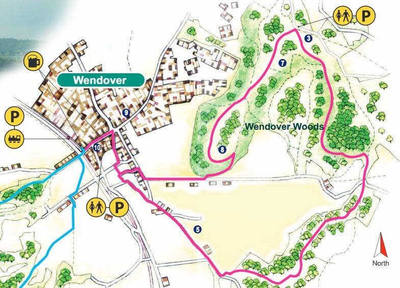
Wendover Woods and Back
We’re lucky to have some great half-day and full-day circular walks taking in stretches of The Ridgeway on our doorstep. The one we have chosen for this issue is from the Chilterns Country Views of the Vale collection.
START/END: Wendover Railway Station, Grid Reference: SP849067
DISTANCE: 7 miles, allow 3½ to 4 hours
TERRAIN: Uphill for about 2 miles. There are no stiles or kissing gates on this route. About a mile of the section from Wendover to The Hale is considerably uphill. There is an All Ability Trail suitable for wheelchairs near Wendover Woods main car park
PARKING: There is car parking at Wendover Woods
LOCAL TRANSPORT: There is a railway station and buses service to nearby Wendover
You can download the Chilterns AONB full description and annotated map of the walk here.
The 7-mile circular walk to Wendover Woods and back follows part of The Ridgeway National Trail. The Woods have wonderful displays of bluebells in late April and early May. There is also a cafe at the main car park, a children’s playground and an ancient hillfort, now rather overgrown. The café is currently open for takeaways.
Route
- Leave Wendover railway station by the road and turn left past the Shoulder of Mutton pub. Continue along Wendover High Street past the shops. Cross the road at the pedestrian crossing and continue down the High Street.
- Just after the last shop turn right onto a footpath (signposted ‘Ridgeway’), which passes through a park alongside a stream – continue to follow ‘Ridgeway’ signs.
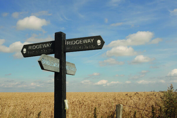
- Go straight on, following The Ridgeway National Trail signs (which are waymarked with an acorn symbol) past the lake and church and along the road. At the crossroads go straight across, up Hogtrough Lane. Continue to follow The Ridgeway, which forks left after Boswell’s Farm into woodland. Follow this forest trail for over one mile gently uphill. You will eventually cross Hale Road and enter Wendover Woods.
- The Ridgeway drops down (via steps) to meet a bridleway in a sunken lane. Turn 90 degrees left here (leaving the Ridgeway) and after some 40 metres take a public footpath to the right. Follow this well waymarked path uphill through the wood until it meets a wider stony track. Turn right along this track and follow it, climbing gently. At a fork of tracks take the right (upper) one, which brings you to the Wendover Woods main car park.
- Follow the tarmac road to the left (the café is ahead of you where you meet the road) and turn left to follow a wide track for ½ mile, which passes picnic areas with barbecues. Keep straight on at a sign for Boddington Bank viewpoint. After 300 metres there is a piece of fitness equipment (part of the fitness trail): do not turn left here – go straight on and follow the track downhill. You will eventually meet another track, turn right and join this track, continuing downhill. Then carry straight on until you reach the road at the bottom.
- Turn right and follow the road back to Wendover (please take care if walking on the road). At the junction turn right and after 50m take the path between houses on your left. This brings you back to the park at the start of the walk. Follow the stream and then on to the Heron Path to come out on the High Street by the Clock Tower. Turn left and walk back up the High Street to the rail station.
Thank you to the Chilterns Area of Outstanding Natural Beauty for supplying this walk. You can find out more on the website at www.chilternsaonb.org and download their full description and annotated map of the walk here.