Walk This Way – Launch of New Hemel Walking Map
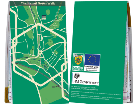
To coincide with May’s National Walking Month, Dacorum Borough Council is proud to launch the new Hemel Green Walk map, a walking route around Hemel Hempstead. The map shows off some of the best places of the town, from the vibrant Town Centre to idyllic green spaces in Two Waters and Gadebridge Park.
The map connects Hemel Hempstead and Apsley stations to the town, highlighting active travel routes. It aims to make neighbourhoods more accessible, bringing walking and cycling connections to life as well as integrate high quality green spaces into our day-to-day lives.
Walking and cycling are also the perfect activities to improve physical, mental and social health and it’s hoped that the Hemel Green Walk map will encourage residents to embrace Hemel’s brilliant natural green spaces, explore the town and improve their health and wellbeing.
Cllr Alan Anderson, Portfolio Holder for Planning and Infrastructure said: ‘Many people have been enjoying the mental and health benefits of walking during lockdown and we hope this trend will continue. This map aims to promote sustainable and active travel, as well as linking together some of the best places of Hemel such as Boxmoor, Jellicoe Water Gardens, the Old Town and Apsley.’
The map can be followed using the LoyalFree app, which can be downloaded for free from the App Store or Google Play.
Hard copies can be collected from one of the following venues:
- The Artichoke
- Hemel Library
- House of Elliot
- Hive
- The Old Town Hall
- The Paper Mill
- The Fishery Inn
- Apsley Train Station
- Hemel Hempstead Train Station
- Liberty Tea Rooms and Community Hub
- Brunch
- Cappuccio
- Tikis
- Jennys
- Story Café
- Marlowes Shopping Centre
- Riverside Shopping Centre
- The Boxmoor Steakhouse
For more information and to download the map visit www.dacorum.gov.uk/thehemelgreenwalk.